

The 10 Best Hikes in Puerto Vallarta: Trails for Every Level
Most people picture Puerto Vallarta as a beach town, and it is, but it is also one of the more underrated hiking destinations on Mexico's Pacific coast. The Sierra Madre drops almost straight into Banderas Bay here, so within a short ride of the Zona Romantica you can climb to a city overlook, follow a jungle river to a waterfall, or trace a cliffside path between hidden coves. This guide walks through ten trails for every level, from a flat boardwalk stroll to a full-day boat-and-jungle adventure, with the distance, time, difficulty, and how to reach each one.
The short answer
Puerto Vallarta's best hikes range from easy in-town viewpoints like El Cerro de la Cruz and the Malecon boardwalk to jungle-river waterfall trails like Palo Maria and Nogalito, the scenic Boca de Tomatlan coastal path to hidden coves, and harder Riviera Nayarit peaks like Cerro del Mono. Waterfalls run fullest in the rainy season (May to October), while dry season gives firmer footing and clearer views. Start early, wear real grip, and carry water. Use the Trail Finder below to match a trail to your day.
Why Puerto Vallarta is an underrated hiking destination
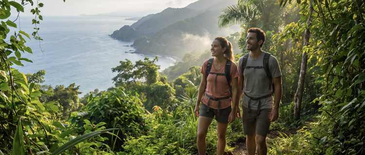
What makes hiking here special is how much variety sits within reach of town. In one direction the mountains rise into jungle canyons threaded with rivers and waterfalls; in another the coastline breaks into a chain of coves you can only reach on foot or by boat; and right in the center, a hilltop cross and a seaside promenade give you big views with almost no effort. Because so many trailheads are a cheap bus ride or a short water-taxi hop away, you do not need a car or a tour to string together a genuinely good hiking week. The one thing to respect is the season: this is a tropical coast, so mornings are cooler and drier, and the same rains that swell the waterfalls also make the rock slick.
Find your trail
Not every trail suits every traveler or every afternoon. Use the Trail Finder to filter the ten by difficulty, how much time you have, and what you want at the end, whether that is a viewpoint, a waterfall, or a beach. Every card shows the distance, the time, and exactly how to get there.
nayahomes.com · Trail Finder
Find your Puerto Vallarta hike
Filter the ten trails by difficulty, how long you have, and what you want at the end. Distance, time, and how to get there are on every card. Pick the filters that fit your day.
1. El Cerro de la Cruz
Insider tip: Climb about 40 minutes before sunset for the city-and-bay glow, then the town lights on the way down.
2. Mirador Conchas Chinas
Insider tip: Pair the overlook with the natural tide pools on Conchas Chinas beach just below on your way back.
3. Nogalito River Trail
Insider tip: Wear grippy water shoes and simply follow the river upstream; the streambed rocks are slick.
4. Cerro del Mono (Higuera Blanca)
Insider tip: Arrange your return ride before you start. Getting transport back from the village on the spot is genuinely hard.
5. Boca to Colomitos to Las Animas
Insider tip: Start by 8:30am and push a few minutes past busy Colomitos to the quieter coves, then boat back from Las Animas.
6. Palo Maria Waterfall Trail
Insider tip: The falls run fullest in rainy season (roughly June to October). Grippy water shoes make the river crossings easy.
7. The Malecon Boardwalk
Insider tip: Walk it near sunset for the Voladores de Papantla pole-flyers, sculptures, and street performers.
8. Mirador del Toro (Los Ayala)
Insider tip: Hike early to have hidden Playa del Toro, past the overlook, mostly to yourself before the boats arrive.
9. Mismaloya to El Eden Trail
Insider tip: Go on a weekday morning and bring swimwear for the river pools at the old Predator film set.
10. Quimixto Jungle Trail
Insider tip: Land by about 10:30am, hike to the waterfall first, then enjoy the near-empty golden beach.
Distances and times are approximate and vary by route, fitness, and season. In rainy season (roughly May to October) waterfalls run fullest but trails and river rocks get slippery, so start early and wear real grip.
The 10 best hikes, trail by trail
1. El Cerro de la Cruz (easy, viewpoint)
The classic first hike in Vallarta is a short, steep climb from downtown to the hilltop cross that overlooks the whole bay. It is only about half a mile round trip, but it is more than 300 steps, so figure on 45 minutes with photo stops. Start on Abasolo Street heading uphill from Centro; from the Zona Romantica it is a 25 to 35 minute walk or a short Uber to the base. Insider tip: climb about 40 minutes before sunset for the light on the water, then watch the town lights come on during the descent. There are no vendors at the top, so bring your own water.
2. Mirador Conchas Chinas (moderate, viewpoint)
Just south of the Zona Romantica, a short scramble through a leafy hillside of villas leads to an ocean overlook of the south shore. The quick version is about half a mile up and takes around 30 minutes, though a longer ridge route exists for those who want more. Take an Uber to the Grand Miramar area or a southbound bus down the highway. Insider tip: the mirador itself is modest, so pair it with the natural tide pools on the Conchas Chinas beaches just below on your way back down.
3. Nogalito River Trail (moderate, waterfall)
This is a jungle river walk in the village of El Nogalito that becomes a boulder-hop upstream past small cascades. The relaxed lower section is a shaded one to two hour ramble; going all the way to the upper waterfall is a longer scramble over slick rock. Take a southbound bus to El Nogalito, then walk about 25 minutes up to the trailhead. Insider tip: wear grippy water shoes and simply follow the river upstream. If you want more swimming-hole detail on this and the other cascades, see our guide to the waterfalls near Puerto Vallarta.
4. Cerro del Mono, Higuera Blanca (hard, viewpoint)
Also called Monkey Mountain, this is the most demanding day on the list: about four miles round trip with a granite-boulder summit and a 360-degree Pacific panorama. It sits up in the Riviera Nayarit, roughly an hour to ninety minutes north of the bay, so most people drive or hire a round-trip driver. Insider tip, and this one matters: arrange your ride back before you start, because getting transport out of Higuera Blanca on the spot is genuinely difficult and hikers get stranded. It is best in the drier months for clear views and firmer footing.
5. Boca de Tomatlan to Colomitos to Las Animas (moderate, beach)
One of the bay's signature hikes traces the coastline from the fishing village of Boca de Tomatlan along an up-and-down jungle path that links a string of secluded coves. It is about 2.7 miles one way and roughly two hours, more with swim stops. Take the Boca bus from Basilio Badillo and Constitucion, then hike one way and catch a water taxi back from Las Animas. Insider tip: start by 8:30am to beat the heat and the boat crowds, and push a few minutes past busy Colomitos to the quieter coves. The beaches along this route are covered in our guide to Banderas Bay beaches by how you reach them.
6. Palo Maria Waterfall Trail (moderate, waterfall)
A short, lush jungle-and-river walk south of town leads to a waterfall and swimming pool tucked in a canyon. It is about 1.6 miles round trip to the first fall, roughly 40 minutes each way, with a few shallow river crossings. Take the Mismaloya bus or a short Uber south. Insider tip: the falls run fullest in the rainy season, roughly June to October, and grippy water shoes make the crossings easy. If you lose the unmarked trail, just keep following the water upstream.
7. The Malecon Boardwalk (easy, viewpoint)
Not every hike needs a mountain. The Malecon is a flat, paved seaside promenade of about 1.9 miles round trip, lined with bronze sculptures, galleries, and bay views, and it is the accessible, no-effort option right in town. It starts in the Zona Romantica, so no transport is needed. Insider tip: walk it near sunset for the Voladores de Papantla pole-flyers and the street performers near the amphitheater. It doubles as an easy warm-up on a rest day.
8. Mirador del Toro, Los Ayala (moderate, viewpoint and beach)
Farther north in the Riviera Nayarit, this steep jungle climb crosses a headland to a Pacific overlook, then descends to a sheltered, calm-water hidden beach. It is about 3.8 miles round trip, roughly 45 minutes to the viewpoint. It is a fair way north of the bay, so it is usually done by car as a day trip. Insider tip: hike early to have secluded Playa del Toro, just past the overlook, mostly to yourself before the water taxis start dropping groups.
9. Mismaloya to El Eden Trail (hard, waterfall)
This jungle-river hike heads up the Mismaloya canyon to natural swimming pools, a waterfall, and the old film set from the 1987 movie Predator, now a riverside restaurant and adventure park. Figure about 3.7 miles round trip and a half day, over jungle terrain that gets slippery after rain. Take the Mismaloya bus, then head inland up the river road past town. Insider tip: go on a weekday morning to beat the crowds and bring swimwear, because the payoff is a dip in the river pools below the falls.
10. Quimixto Jungle Trail (moderate, waterfall and beach)
Quimixto is a boat-in fishing village where a short jungle trail leads to a swimmable waterfall pool, paired with an uncrowded golden beach. The hike is only about 30 to 45 minutes each way, but the whole outing is a half day once you count the boat. Access is by water taxi only, from Boca de Tomatlan or the Los Muertos Pier. Insider tip: aim to land by about 10:30am, hike to the falls first, then have the long beach nearly to yourself before the tour boats arrive.
Before you go: trail prep
A little preparation turns a good hike into an easy one here. For footwear, closed-toe trail shoes with real grip handle almost everything, but bring grippy water shoes for the river hikes where you cross or scramble on wet rock. Carry at least a liter of water per person, since most of these trails have nothing for sale along the way, and add sun protection and bug repellent for the jungle routes. Start early, ideally at or near sunrise, to beat the heat, the humidity, and the afternoon storms that are common in the wet months.
Season shapes the experience more than anything. Rainy season, roughly May through October, delivers the fullest waterfalls and the greenest jungle, but the trade-off is mud, slick rock, and higher, faster river crossings, so stick to morning starts and watch your footing on the steep sections. Dry season, roughly November through May, gives you firmer footing and the clearest summit views, at the cost of thinner waterfalls. Either way, carry small pesos in cash for buses, water taxis, and the occasional informal trailhead fee.
Frequently asked questions
When is the best time of year to hike in Puerto Vallarta?
Both seasons work, they just offer different things. Dry season, roughly November through May, gives you firmer footing and the clearest summit views, though the waterfalls shrink. Rainy season, roughly May through October, brings the fullest, most dramatic waterfalls and the greenest jungle, but trails and river rocks turn slippery and afternoon storms are common, so hike in the morning.
What should I wear and bring?
Closed-toe trail shoes with real grip for almost everything here, plus grippy water shoes for the river hikes like Palo Maria, Nogalito, El Eden, and Quimixto where you cross or scramble on wet rock. Carry at least a liter of water per person, since most trails have nothing for sale mid-route, along with sun protection, bug repellent for the jungle trails, and small pesos in cash for buses, water taxis, and the occasional trailhead fee.
How do I reach the trailheads without a car?
Most of the in-town and south-shore trails are reachable by the cheap local buses that leave from Basilio Badillo and Constitucion in the Zona Romantica, or by a short Uber. The boat-access trails like Quimixto use water taxis from Boca de Tomatlan or the Los Muertos Pier. The two Riviera Nayarit peaks are the exception: they sit well north of the bay and are far easier with a car or a pre-arranged round-trip driver.
Which hike is best if I only have a couple of hours?
El Cerro de la Cruz is the classic quick win: a short, steep staircase from downtown to a hilltop cross with a full bay panorama. The Malecon boardwalk is the flat, no-effort option right in town, and the Mirador Conchas Chinas climb is a brief scramble to an ocean overlook just south of the Zona Romantica. All three fit comfortably into an afternoon.
Which hikes end at a waterfall or a beach?
For waterfalls, aim for Palo Maria, the Nogalito river trail, Quimixto, or the Mismaloya to El Eden jungle hike. For beaches, the Boca de Tomatlan coastal trail delivers you to a string of hidden coves ending at Las Animas, and Mirador del Toro drops to a quiet swimming beach. Our companion guides to the area's waterfalls and its beaches by how you reach them go deeper on each.
Do I need a guide, and are the trails safe?
Most of these you can do independently. A guide helps on the longer jungle-river routes and the remote Nayarit peaks, mainly for route-finding. The biggest cautions are simple: start early to beat heat and afternoon storms, wear real grip because rainy-season rock is slick, tell someone your plan, and on the far-north Nayarit trails arrange your ride back before you set out so you are not stranded.
Stay near the trailheads
The easiest hiking week starts with the right base. A rental in the Zona Romantica puts you within walking distance of El Cerro de la Cruz and the Malecon and a short bus ride from the south-shore and coastal trails. Browse Naya Homes vacation rentals across Puerto Vallarta, or explore the wider Puerto Vallarta area to plan your trip.
Find your Puerto Vallarta rental